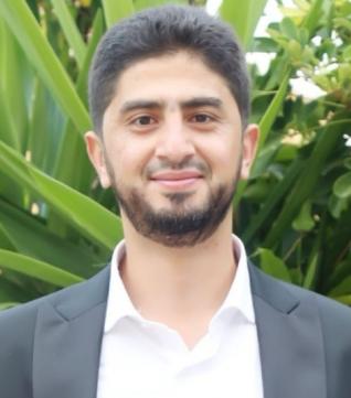

-
 Rank
Rank
Professor -
 Degree
PhD -
 Specialization
Geomatics -
 Major
Major
Remote Sensing & GIS
Born in Aidamon-Akkar, 1986
Scientific Qualifications
- PhD in Geomatics from the Graduate School of Land Surveyors and Topographers (ESGT), France in 2012;
- Engineer Diploma from the Graduate School of Land Surveyors and Topographers (ESGT), France in 2009;
- 1st and 2nd year – Mathematics in the Faculty of Science (Branch 3) of the Lebanese University between 2004 and 2006.
Professional Career
- Lecturer at the Faculty of Letters & Human Sciences (Branch 3) at the Lebanese University in the academic year 2012-2013 and Director of Branch 3 since 2021;
- Assigned Director of the FLHS – Branch 3 between 2021-2024;
- Head of the Geography Department at the Faculty of Letters & Human Sciences (Branch 3) at the Lebanese University between 2017 and 2019;
- Member of the Council of Delegates in the Association of Full-Time Professors at the Lebanese University since 2018;
- Supervisor and rapporteur of Master theses and PhD dissertations in Geomatics, Geography, Environmental Engineering and Civil Engineering;
- Member of the Order of Engineers and Architects in Tripoli since 2015;
- Member of the Lebanese Geographic Society since 2014;
- Researcher at the National Center for Remote Sensing of the National Council for Scientific Research (CNRS-Lebanon) in 2013;
- Member of the scientific team of the "Lebanese Satellite" program, which aims to manufacture the first Lebanese satellite;
- Member of the Scientific Team of the Satellite (BIOMASS) developed by the European Space Agency (ESA);
- Visiting researcher at the Center for the Study of the Biosphere from Space (CESBIO) in Toulouse, France, since 2017, and at Boston and Northeastern Universities in the United States of America in 2015;
- Author of researches and articles published in international peer-reviewed journals and conducted in international laboratories and research centers such as the US Space Agency (NASA), the National Center for Space Research in France (CNES) and the National Institute for Space Research of Brazil (INPE) on remote sensing techniques and GIS and their uses in the study of surface and ground water and pollution.
 LU Services
 League of Retired Professors
 News
News
 Vacancies
 International Relations
 Contact Us
 Email
Email

